
Winter Maps & Terrain
Explore our Vermont snow mountains
With two mountains, four terrain parks sporting over one hundred features, six peaks, sixteen lifts, nearly thirty wooded areas, and the 2,000 acre Slide Brook Basin, there’s no question that Sugarbush is one of New England’s largest ski areas. Amenities include multiple base lodges, resort lodging, onsite restaurants, retail and rental shops, and more.
rich-text, responsive-table

Winter Trail Map PDF
View the winter trail map of Lincoln Peak and Mt. Ellen.

Interactive Trail Map
Interactive with lift and trail status for Lincoln Peak and Mt. Ellen.

Base Area Map
View a printable version of the Lincoln Peak Base Area Map.

Snowshoe Map
Snowshoe trails at Lincoln Peak and Mt. Ellen.

Nordic Trail Map
See the nordic trails at the Sugarbush golf course.

Uphill Travel Maps
View a printable version of our three Uphill Travel Routes.
-
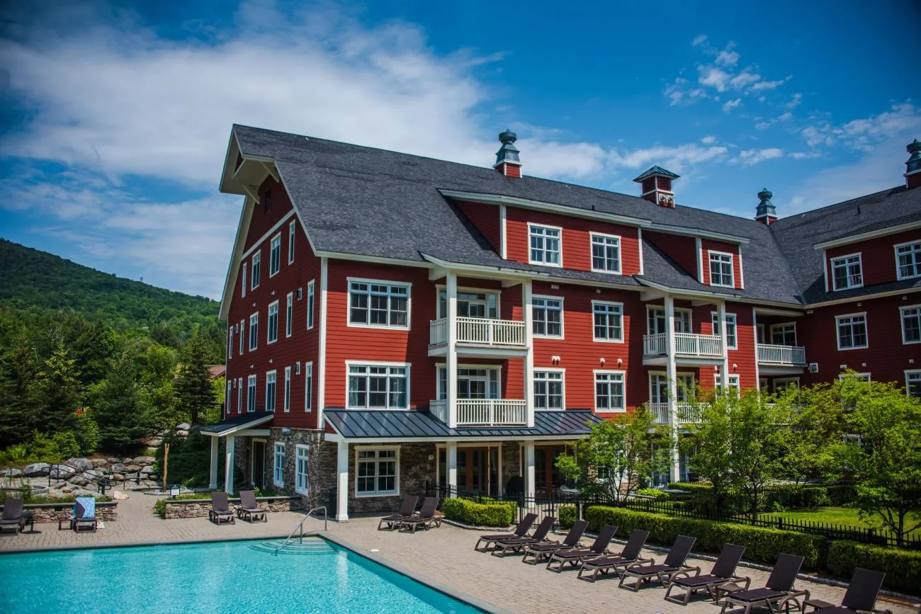
At the heart of Sugarbush is Lincoln Peak—think quintessential Vermont meets modern slopeside living. Here you’ll find the majority of Sugarbush terrain with classic New England trails leading to the nascent Lincoln Peak Village which includes Clay Brook slopeside hotel and residences, a general store, casual and elegant dining, and the new Schoolhouse and Farmhouse. The Schoolhouse is home base for all children’s day ski-and-ride programs, and The Farmhouse hosts Sugarbush’s acclaimed Ski & Ride School which includes the first-timer-to-life-timer program, private and group lessons, backcountry tours, bumps clinics and more.
rich-text, responsive-tableLINCOLN PEAK
Trail Count: 72
Terrain Parks: 2
Wooded Areas: 17
Summit Elevation: 3975'/1212 m
Base Elevation: 1575'/480 m
Vertical Drop: 2400'/732 m
Lifts: 10 (including 2-way Slide Brook connector to Mt. Ellen) rich-text, responsive-tablecarousel-component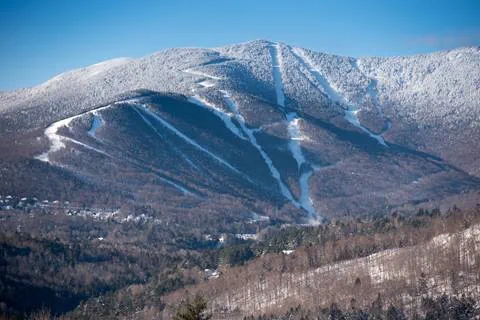
 BARRIE FISHER
BARRIE FISHER
BARRIE FISHER -
Mt. Ellen’s casual feel speaks to the ski bum—but don’t let that fool you. Mt. Ellen is home to Vermont’s highest chairlift, our premiere terrain park, Green Mountain Valley School's elite ski racing academy, is a designated U.S. Ski Team Development Site and is the northern Vermont location for Vermont Adaptive Ski and Sports. Mt. Ellen tends to be our local's favorite with a greater sense of old-school Vermont charm.
rich-text, responsive-tableMT. ELLEN
Trail Count: 39
Terrain Parks: 2
Wooded Areas: 11
Summit Elevation: 4083'/1245 m
Base Elevation: 1483'/452 m
Vertical Drop: 2600'/793 m
Lifts: 7 (including 2-way Slide Brook connector to Lincoln Peak) rich-text, responsive-tablecarousel-component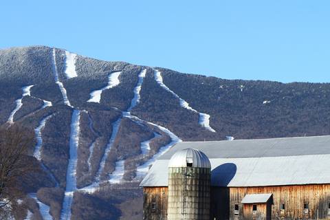
-
Beyond resort boundaries, between Lincoln Peak and Mt. Ellen, lies the 2000-acre Slide Brook Basin. Slide Brook Basin is home to a variety of wildlife, including moose, black bear, white-tailed deer, and many other species. During the winter, it’s also home to skiers and riders seeking backcountry solitude.
rich-text, responsive-tablecarousel-component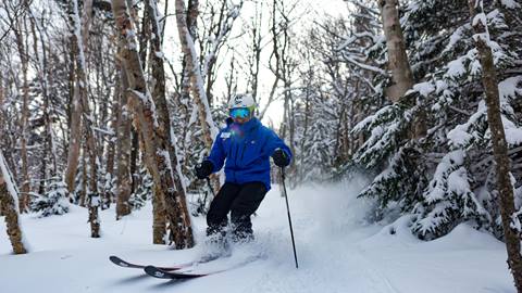
Those wishing to access Slide Brook are recommended to use a Sugarbush Ski & Ride School Private Lesson or Snowshoe Guide. Please be aware that upon entering Slide Brook Basin you are leaving resort boundaries and are subject to Off-Trail Policies.
The wooded areas in Slide Brook Basin descend towards Slide Brook Road, which leads to German Flats Road. A Mad Bus stop is located at the bottom of Slide Brook Road at German Flats Road, where skiers and riders can catch a lift back to either Lincoln Peak or Mt. Ellen base areas.
Off-Trail Policies
Wooded areas are not patrolled and have no skier/snowboarder services. If you ski/ride in wooded areas, you are solely responsible for yourself. Woods are recommended for expert skiers/riders in groups of three or more. Do not ski/ride alone. Unmarked obstacles exist throughout.
VERMONT LAW provides that you are liable for all expenses related to search and/or rescue if you venture off of designated trails or beyond the ski area boundary.
rich-text, responsive-table -
Learn about our multiple skinning/ uphill, and downhill routes - there are uphill safety protocols that must be followed, like checking the status of the routes on the snow report to make sure they are open. There's also a free uphill pass that you'll need to get.
UPHILL TRAVEL rich-text, responsive-table -
TERRAIN
Total Acres: 4,000+
On-Trail Acres: 484
Trail Count: 111
Terrain Parks: 4
Wooded Area Acres: 97
Length of Trail: 53.2 miles/85 km
Wooded Areas: 28
Summit Elevation: 4,083'/1,245 m
Base Elevation: 1,483'/452 m
Vertical Drop: 2,600'/793 m
Average Annual Snowfall: 250"/635 cm
rich-text, responsive-tableLIFTS
High-Speed Quads: 5
Fixed-Grip Quads: 5
Triples: 2
Double: 1
Surface Lifts: 3
Total: 16
Uphill Capacity: 25,225
THE MOUNTAINS
Mt. Ellen: 4,083'/1,245 m
Lincoln Peak: 3,975'/1,212 m
Castlerock Peak: 3,812'/1,162 m
North Lynx Peak: 3,300'/1,006 m
Gadd Peak: 3,150'/960 m
Inverness Peak: 2,750'/838 m rich-text, responsive-table -
TERRAIN COUNT ACRES % GREEN CIRCLE 26 108 18.7% BLUE SQUARE 47 227.6 33.8% BLACK DIAMOND 30 116.8 21.6% DOUBLE BLACK DIAMOND 8 31.9 5.8% WOODED AREAS 28 97 20.1% TOTALS 139 581 100%
rich-text, responsive-table


Lincoln Peak and Mt. Ellen
-
lifts
16 -
trails
111 -
wooded areaS
28